It looks like I've done 50 miles of trail since I started this blog, so that's a good start given the temps this winter. Yesterday, it was 60 degrees here, but the Polar Vortex is back and now it's 10 and will be 0 tonight, so I'm glad I got out yesterday.
Current temperature in Grand Marais, MN, near the northern end of the trail is -26, not counting wind chill from a 20 mph wind. Ugh. Extreme wind chills have shut down much of MN today.
I definitely don't miss the cold or darkness of Minnesota winters. In northern Minnesota, there are more than 15 hours of daylight during the longest days of summer, but only about 8 during the shortest days of winter. Long daylight hours in the summer means lots of time to cover miles, but the sun will come up around 5 a.m., so I'll have to get up early if I want to see many sunrises from the trail.
Monday, January 27, 2014
7-ish (?) mile hike: Eldon Hazlet State Park
After feeling down about yesterday's hike, I thought I should get right back on the trail, especially since temps were supposed to be in the 50s today but drop down near 0 later this week. However, I didn't feel like driving very far to find hills, so I thought I'd explore a state park over on Carlyle Lake.
Jeff and I first experienced Carlyle Lake on the first night of our bicycle tour in 2012. We'd left our brand new home just two weeks after moving there from Utah in an ill-fated attempt to ride our bicycles from home, around Lake Michigan, and back. That first day of our trip, we left later than planned. I was clearly out of shape and ill-prepared for midwestern humidity after three years of living in the arid west. The previous weeks had been filled with the usual relocation stresses, and I was coming down with a bad cold but it was 96 degrees when we got to Carlyle, and I was ready to be off the bike. We did find Dairy Queen that day, but we also found out about the misfortunes of trying to sleep in our tent while the RV just behind us decided to host a showing of Footloose by setting up a projector and a sheet hung on the side of the RV as a screen. Here is an account of the rest of that night...
Needless to say, my opinion of Carlyle Lake and the campers it attracts is not high. Additionally, the hiking trails are open only two days per week during two months of pheasant hunting in the park, so I'd been avoiding the place. However, I wanted something nearby that wasn't Silver Lake, which would be very muddy on this warm day, and that wouldn't be too challenging since my ego was bruised after yesterday's encounters with the cold wind at Pere Marquette, so I headed out to Carlyle.
Thankfully, almost no one was around. There were no impromptu showings of movies or other things to interrupt my time outdoors. There were still a couple of signs up saying that the trails were closed for pheasant season, but that was to have ended during the first week of January, so I headed out.
This park has a number of small loop trails, and the mileage on some of them seems to be a bit off. Either that or I hiked super fast for the first mile and a half. By the map, I did 8 miles, but I think it was really more like 7, so I'm going to say 7.


After a few miles, I had looped back to the parking area where I took advantage of a nearby platform to enjoy a good snack in the warm sun. It was much more relaxing than my snack break yesterday since the wind wasn't buffeting me at every turn.

Jeff and I first experienced Carlyle Lake on the first night of our bicycle tour in 2012. We'd left our brand new home just two weeks after moving there from Utah in an ill-fated attempt to ride our bicycles from home, around Lake Michigan, and back. That first day of our trip, we left later than planned. I was clearly out of shape and ill-prepared for midwestern humidity after three years of living in the arid west. The previous weeks had been filled with the usual relocation stresses, and I was coming down with a bad cold but it was 96 degrees when we got to Carlyle, and I was ready to be off the bike. We did find Dairy Queen that day, but we also found out about the misfortunes of trying to sleep in our tent while the RV just behind us decided to host a showing of Footloose by setting up a projector and a sheet hung on the side of the RV as a screen. Here is an account of the rest of that night...
Needless to say, my opinion of Carlyle Lake and the campers it attracts is not high. Additionally, the hiking trails are open only two days per week during two months of pheasant hunting in the park, so I'd been avoiding the place. However, I wanted something nearby that wasn't Silver Lake, which would be very muddy on this warm day, and that wouldn't be too challenging since my ego was bruised after yesterday's encounters with the cold wind at Pere Marquette, so I headed out to Carlyle.
Thankfully, almost no one was around. There were no impromptu showings of movies or other things to interrupt my time outdoors. There were still a couple of signs up saying that the trails were closed for pheasant season, but that was to have ended during the first week of January, so I headed out.
This park has a number of small loop trails, and the mileage on some of them seems to be a bit off. Either that or I hiked super fast for the first mile and a half. By the map, I did 8 miles, but I think it was really more like 7, so I'm going to say 7.
Early in the hike, I came to the Burnside Cemetery, where early pre-Civil War residents of the area are buried. A geocache box was near the cemetery.
Since I hadn't seen anyone yet, I decided that this place isn't half bad when there aren't annoying people around. There was a sign at the entrance saying that you couldn't bring in alcohol in containers larger than 1 gallon, so I doubt I'll come here when the campers and boaters are here, but when the lake is frozen, it's an ok place to visit. Most of the trails were covered in a thick layer of leaves, so the trails weren't too muddy, either, which was nice.
I thought this twisted stump looked like some swamp creature. Rawr!
After a few miles, I had looped back to the parking area where I took advantage of a nearby platform to enjoy a good snack in the warm sun. It was much more relaxing than my snack break yesterday since the wind wasn't buffeting me at every turn.
I then headed back out for another loop of about 3.5 miles. The two trails that made up this loop weren't as nice as the ones by the lake since they were muddier and often had plenty of these gumballs from Sweetgum trees littering the ground. Gumballs are pervasive in these parts, and they're kind of a pain to walk on because they roll and/or slide like loose gravel when you step on them. I just pretended like they were the rocks and roots of the Superior Trail and kept moving. I lost the trail a couple of times in the leaf litter before looping back to the parking lot, but I still had a nice walk in the woods on a day that felt more like April than January.
Sunday, January 26, 2014
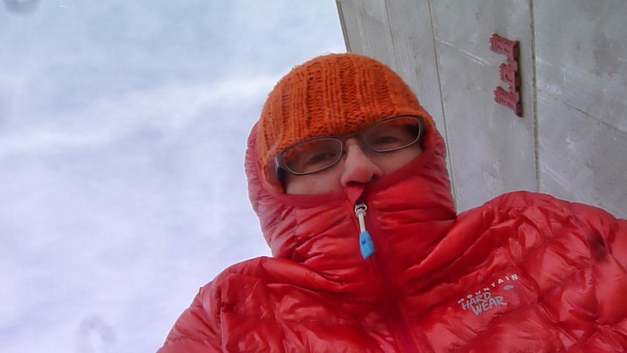
6 mile hike: Pere Marquette State Park
When I left home on Saturday morning and headed toward Pere Marquette State Park, I had high expectations for the day. The sun was shining, temps were just above 40 degrees, and it looked like a perfect hiking day. However, as I neared the park, more and more clouds rolled in. It started sprinkling a bit, let off, and then started sleeting in earnest. So much for my perfect day. I pulled into a gas station to get some coffee and kill a few minutes while hoping that the sleet was not going to stick around, but it continued as I drove into the park, made a quick stop at the visitor's center, and tried to guess how the weather would play out for the rest of the day. If nothing else, I thought it would be good mental training to walk in the wet, chilly conditions, but I still hung out in my car for about 15 minutes drinking my coffee and hoping for something better than sleet.
I'd finally resigned myself to the sleet and was pulling out my raincoat when the sleet changed to graupel-type snow. Snow=drier than sleet, so I was happy with that when I hit the trail and even happier when the precipitation stopped after less than 30 minutes.
Winter in Illinois means that everything is brown, and while I'm sure these trails are picturesque in the spring, there's just not much to take pictures of during this season, especially when it's cloudy, but before I hit the trail, I did take a picture of a special snack I had packed for myself.

This is the Big Musubi. I got hooked on Spam Musubi during our vacation in Hawai'i last summer but hadn't yet tried to make it myself. Since I don't own a musubi mold, I had to make do. The closest thing I had was a small loaf pan, so I ended up with Big Musubi, which is about 1.5x longer than a regular musubi. After about 2.5 miles, I was getting a little hungry, but the hike was finally becoming pleasant since the sun had come out, so I wanted to keep moving. Plus, I thought I would enjoy Big Musubi more if I were hungrier, so I pressed on.
At the point of the trail furthest from my car, I crossed a road and dropped down on the opposite side of the ridge I'd been walking parallel to. I immediately realized my pleasant hike was much less pleasant on this side of the ridge since the wind was hitting that side fairly forcefully. The trail on that side also got far less sun, and it was covered in snow much of the time. The windbreaker, gloves, and hat I'd taken off just a quarter mile before suddenly became necessary again, and the cold, shaded, snowy, windy trail was no place to enjoy Big Musubi. I should have grabbed another snack to eat while walking since I hadn't eaten much that morning, but I set my sights on having Big Musubi on top of McAdams Peak, another 1.5 miles on the windy side of the ridge.
By the time I got there, though, the wind had gotten much worse, I was grumpy from walking 5+ miles with no snacks and very little breakfast, and even more grumpy when I realized that I couldn't enjoy Big Musubi at the shelter at the top because there was no way to get out of the wind that whipped around all the corners of the little lookout building at the top of the hill.

You know those weather videos where the weatherperson is yelling over the wind to tell you how windy it is? That's what the top of McAdams peak was like. I snapped a couple of pics and chose a trail to take back to the parking lot.

As soon as I dropped down below the peak, I got out Big Musubi and had my snack as I walked. I had the wrong kind of rice, and it wasn't packed tightly enough, but by that point, it tasted delicious. I spent the next 1/4 mile scarfing it down and trying to block it from the wind.
However, Big Musubi came too late to save me from myself. My original plan was to get down to the visitor center and then head out on a different loop to add a few more miles to my total for the day. However, the wind and lack of snacks had taken away a good part of my gumption. All the trails led back into the wind. Almost before I made a conscious decision, my key was in the ignition and I was getting the heck out of there.
While I didn't put in the miles that I'd planned to, I'm still happy that I got in a few miles on a fairly hilly route with the full pack. Jeff and I visited this park last year, and the heat, hills, and humidity had made me very tired after just 3 miles on that visit. I'll still take chilly temps over heat, but the wind on top of near-freezing temperatures wore me down.
Soon after leaving, I felt that I'd let myself down by not doing as many miles as I'd planned just because of some stupid old wind, but when I looked at the weather when I got home, I could see that sustained winds had been 30 mph with gusts up to 43 mph, putting the wind chill down around 15 degrees. I didn't feel so bad then. I'll definitely go back to this park, though, since it has some of the sustained hills I need for my training.
Post-hike: On the way home, I stopped at the National Great Rivers Museum and the Melvin Price Locks and Dam. My primary impression of the museum is that it was toasty and warm. The area outside by the locks...not so much.

I'd finally resigned myself to the sleet and was pulling out my raincoat when the sleet changed to graupel-type snow. Snow=drier than sleet, so I was happy with that when I hit the trail and even happier when the precipitation stopped after less than 30 minutes.
Winter in Illinois means that everything is brown, and while I'm sure these trails are picturesque in the spring, there's just not much to take pictures of during this season, especially when it's cloudy, but before I hit the trail, I did take a picture of a special snack I had packed for myself.
This is the Big Musubi. I got hooked on Spam Musubi during our vacation in Hawai'i last summer but hadn't yet tried to make it myself. Since I don't own a musubi mold, I had to make do. The closest thing I had was a small loaf pan, so I ended up with Big Musubi, which is about 1.5x longer than a regular musubi. After about 2.5 miles, I was getting a little hungry, but the hike was finally becoming pleasant since the sun had come out, so I wanted to keep moving. Plus, I thought I would enjoy Big Musubi more if I were hungrier, so I pressed on.
At the point of the trail furthest from my car, I crossed a road and dropped down on the opposite side of the ridge I'd been walking parallel to. I immediately realized my pleasant hike was much less pleasant on this side of the ridge since the wind was hitting that side fairly forcefully. The trail on that side also got far less sun, and it was covered in snow much of the time. The windbreaker, gloves, and hat I'd taken off just a quarter mile before suddenly became necessary again, and the cold, shaded, snowy, windy trail was no place to enjoy Big Musubi. I should have grabbed another snack to eat while walking since I hadn't eaten much that morning, but I set my sights on having Big Musubi on top of McAdams Peak, another 1.5 miles on the windy side of the ridge.
By the time I got there, though, the wind had gotten much worse, I was grumpy from walking 5+ miles with no snacks and very little breakfast, and even more grumpy when I realized that I couldn't enjoy Big Musubi at the shelter at the top because there was no way to get out of the wind that whipped around all the corners of the little lookout building at the top of the hill.
You know those weather videos where the weatherperson is yelling over the wind to tell you how windy it is? That's what the top of McAdams peak was like. I snapped a couple of pics and chose a trail to take back to the parking lot.
As soon as I dropped down below the peak, I got out Big Musubi and had my snack as I walked. I had the wrong kind of rice, and it wasn't packed tightly enough, but by that point, it tasted delicious. I spent the next 1/4 mile scarfing it down and trying to block it from the wind.
However, Big Musubi came too late to save me from myself. My original plan was to get down to the visitor center and then head out on a different loop to add a few more miles to my total for the day. However, the wind and lack of snacks had taken away a good part of my gumption. All the trails led back into the wind. Almost before I made a conscious decision, my key was in the ignition and I was getting the heck out of there.
While I didn't put in the miles that I'd planned to, I'm still happy that I got in a few miles on a fairly hilly route with the full pack. Jeff and I visited this park last year, and the heat, hills, and humidity had made me very tired after just 3 miles on that visit. I'll still take chilly temps over heat, but the wind on top of near-freezing temperatures wore me down.
Soon after leaving, I felt that I'd let myself down by not doing as many miles as I'd planned just because of some stupid old wind, but when I looked at the weather when I got home, I could see that sustained winds had been 30 mph with gusts up to 43 mph, putting the wind chill down around 15 degrees. I didn't feel so bad then. I'll definitely go back to this park, though, since it has some of the sustained hills I need for my training.
Post-hike: On the way home, I stopped at the National Great Rivers Museum and the Melvin Price Locks and Dam. My primary impression of the museum is that it was toasty and warm. The area outside by the locks...not so much.
I also briefly thought about stopping at the Lewis and Clark Confluence Tower and climbing the stairs to the top instead of taking the elevator as penance for stopping my hike early, but I decided to save that for another trip as well, maybe when I wouldn't be afraid that I'd be blown from the top of the tower...
Tuesday, January 21, 2014
4.5 Mile Hike: Silver Lake
The day after my hike at Castlewood, I went back to Silver Lake and did the quick 4.5 mile trail there. Actually, it wasn't as quick as my last trip there since I had ice, snow, and mud to deal with, but it was still a nice jaunt.

If you're the kind of person who likes stepping on those ice-covered air bubbles that appear in puddles, this was the day for you. I used my poles to stab a bunch of those ice bubbles that had formed along the small creeks and stepped on some in the puddles in low-lying areas. It was quite satisfying.

If you're the kind of person who likes stepping on those ice-covered air bubbles that appear in puddles, this was the day for you. I used my poles to stab a bunch of those ice bubbles that had formed along the small creeks and stepped on some in the puddles in low-lying areas. It was quite satisfying.
As there will always be on this trail, there was plenty of noise from the interstate, but this is a trail conveniently close to my house, so even if it's noisy and doesn't have much elevation gain/loss, I'm sure I'll be out on it a few more times this winter.
After a couple of days in a row with a full pack, I'm happy that I'm not very sore. I can feel that my calves have had a workout from the Castlewood hills and my lower back is just a tiny bit stiff, but my feet and everything else feel ok. This hike wasn't very challenging, but I did really push my pace the last mile and a half after I got away from the icy parts.
8.5 mile hike: Castlewood State Park
I live in a flat, flat area, so it can be challenging to find hills for training. After asking around, everyone told me that the best hills were in Castlewood State Park just west of St. Louis, so I headed there with a full pack (23 pounds) to hit the hills.

The park consists of a number of trails that loop back through the parking areas, so I decided to do 3 trails--River Scene, Grotpeter, and Lone Wolf--for a total of 8.5 miles. Many of the trails are shared with mountain bikers, and I'd been warned that the trail system was popular. The River Scene trail was definitely a busy one, especially with people out walking dogs. This uphill was the first of the day, and I was feeling the burn since I hadn't warmed up at all. I definitely wasn't alone on the trail. The trails in this park are so popular that they include a number of Emergency Locator posts, presumably for people who get hurt and don't have a map to tell people where they are. I've noticed with these urban parks that almost no one carries anything with them. I guess you don't need much emergency gear when there are a hundred other people on the trail. I definitely stood out with my full backpack, and a number of people asked me what I was training for.

After the big hill, the trail leveled off on the top of a bluff along the Meramec River. I looked for bald eagles but didn't see any. I then descended a huge flight of steps down to a tunnel that took me to the river's edge. My map showed that I wouldn't have any more big hills on this route, which was kind of a disappointment, but the muddy trail provided a little extra resistance, so I still got a workout.


The trail looped back to the parking area, and I headed out on the Grotpeter Trail, which had a few more hills and far fewer people.

This picture is basically an excuse to take a break in the middle of the biggest hill on the trail. At the top, I met a couple who told me that they were thinking about doing the Appalachian Trail when they retired and wished me well on my trip. Later, I met the only other person I saw with a big backpack and we chatted for a bit about pack weight and having people look at us funny when we wear our backpacks around our neighborhoods.

The mud on the trails was really slowing me down, but I figured it was good training for the mud I'll probably find in Minnesota in the spring, too. I guess I should have gotten out earlier in the day when the trails were still frozen, but these trails see so much use since they're basically in an urban area that I wasn't doing much damage by being on them when they were muddy.
At the end of the Grotpeter trail, I took a break for a snack before hitting Lone Wolf, the shortest of the three trails but one with a solid hill at the beginning. The sun doesn't reach much of this trail, and it was unexpectedly icy due to snow melt running off the nearby slopes and refreezing at the bottom right on the trail. I took the rubber tips off my poles and relied on the metal tips for traction in quite a few places. Where there wasn't ice, there was mud, so even though the trail was just 1.5 miles long, it took me nearly an hour to complete.

As the sun was going down, so were the temperatures, so I was ready to get back to my car and head home. I was hungry and knew my husband would be, too, since he was out on a bike ride, so I stopped at Chipotle on the way home to get dinner.
The pack felt good with 23 pounds (all gear + 3-4 days of food). I've been having trouble committing to this pack since the pack itself weighs over 3 pounds, but I think I'm going to stick with it for now. If I end up doing other long trips in the future, I will probably try to find an ultralight pack I like, but this one fits well and carries well, so I'll probably start modifying it soon to cut some weight off it.
Overall, Castlewood was more challenging than many of the other trails in the area, but it wasn't as hilly as I'd hoped. If I go back, I'll probably do the trails in the opposite direction I did this time so I can take advantage of the lengthy stair climb on River Scene and see how the hills are then. The hill from the parking lot up to the bluff on either River Scene or Lone Wolf would be good for hill repeats, but it's hard to get excited about driving an hour to do hill repeats. My calves are a little sore from this hike, but it's clear that I need to spend more time at the gym on the stair climber machine since I can't get many hills nearby to train on naturally.
Monday, January 20, 2014
Food Stockpiling!
It seems sort of weird that the start date of this trip is close enough that I can start stockpiling packaged food, but I saw peanut butter packets on sale on Amazon and decided that a trip to Whole Foods and Trader Joe's would give me a good start on figuring out my food for the trip. I've decided to mostly eat granola/food bars, packaged nuts, peanut butter, etc. for breakfast and lunch and do Freezer Bag Cooking for dinners. The bars/nuts/etc. can be very calorie dense, which means they weigh less than many other food options. Also, there aren't many grocery stores along the trail, so resupplying myself through the mail seems like the best bet.
I'll leave some room in my daily rations to add whatever junk foods I'm craving and can get at gas stations, but I prefer to not have to worry about or spend too much time on tracking down food in towns for this trip. I may get tired of some of these foods, but I know when I was on the bike trips that I usually wanted a constant stream of snacks during the day and a mix of sweet and salty things. I ate a lot of nutty bars on the cross-country bike trip, but I'm trying to get better nutrition this time around.

A lot of backpackers carry peanut butter because it's one of the most calorie dense foods you can carry that isn't straight oil or butter. Most of those people carry a jar of PB because it's cheaper, but I'm going with packets because I'm not so good at rationing PB and because I like some of these different flavors. Plus, the packets are easier to eat on the go.

This picture makes my husband sad because it's a whole bunch of granola bars that he doesn't get to eat. I did bring him two boxes of his own, but I kept 60 bars for myself. We have been taste-testing a lot of different bars. I'll take some more specialized energy bars, but these from Trader Joe's are good for breakfast or snacks.

The cat is very unhappy about all this food packing. Packing of any kind makes her nervous because it usually means we're going to leave. Normally, she would sit on a suitcase to show her displeasure, but instead, she's trying to sit on some sesame seed bars and shortbread cookies. I'm not sure what she's thinking, but I know she's thinking that this messy food stockpile isn't a good sign...
Wilderness First Aid Course
Just before the semester started up, I went over to the University of Missouri for a 2-day, 16 hour Wilderness First Aid course put on by Solo. We spent part of the time in the classroom learning basic anatomy and physiology as it relates to Wilderness First Aid and part of the time practicing assessing someone for injuries, splinting broken bones, taking vital signs, etc. For most simulations, our instructor used makeup to give us some injuries that our classmates needed to fine, like this sweet fake ankle bruise I got for one simulation.

The biggest difference between Wilderness First Aid and regular First Aid is the amount of time that you're away from help. In day-to-day situations in populated areas, regular first aid has a goal of treating and keeping someone alive for up to an hour, which is usually the longest it takes to get to a hospital. In WFA, that hour extends to a full 24 hours, and often beyond, as the time needed to get help to an injured person and then get the injured person to a medical facility greatly increases once you're away from roads. As a result, we talked a lot about assessing for more hidden injuries (my ankle bruise also came with a nasty big bruise on my back that indicated kidney bleeding) that may affect treatment in that 24-hour period in a way that they wouldn't if you were just waiting for an ambulance in town.
The other major difference was in learning how to use items in your pack to care for injuries. My hiking poles became a lower leg splint. Someone's vest helped hold a broken wrist. A bear bagging cord was paired with an inflatable mattress to immobilize someone from their ankle to mid-thigh. Stuff like that. I'm pretty good at making do with what I have available to solve problems (I fixed Jeff's bicycle mirror with a coffee stirrer and some duct tape one time), so the MacGyvering appealed to me.
We didn't cover everything I'd hoped to learn, but I am glad I took the course. I haven't completely nailed down my first aid kit for the trip, and I'll add a few things I might not have otherwise added as a result of the course, but in general, I feel better about assessing and doing basic treatment on myself and others who might get into trouble out in the woods. I may or may not use the knowledge from this course (hopefully I won't have to!), but taking it seemed like the responsible thing to do, particularly when I'm spending more and more time out in the woods.
Ultralight Mascots
Status: In the bag!
Weight: 2 g.
Mods: None, but need to figure out how to attach them to my pack
Alternatives: Sadness from not having a mascot
After Turkey Run, we spend an evening with good friends up in West Lafayette, Indiana, where I'd lived for a number of years during grad school. That visit doesn't have much to do with my hiking trip except that I knew I would be able to get myself an ultralight mascot there.
Von's Shops is a book/record/fashion/jewelry/card/bugs trapped in resin/geode shop at the edge of Purdue's campus. They have more beads than I ever thought possible, including many animal ones. For my 2006 trip, I carried a turtle bead from Von's with me across the entire country as a reminder that even though I was slow, I was getting somewhere. Actually, I had two turtles, intending to release one on the east coast and one on the west, but I forgot to release the east coast one and ended up giving it to someone else as a mascot in Damascus, VA.
I know it's silly, but I like having some sort of mascot. Here are the contenders for this year:
The koala is so goofy looking that I think it will have to come along. Perhaps the squirrel can be a talisman protecting my food bag from little critters, and if both the koala and squirrel come along, I can't very well leave the platypus home alone. In total, they weigh barely two grams, and if they make me smile a few times during tough days, they will have proven their weight. None of them have names yet, though...
1.5 + 5 mile hikes: Turkey Run State Park
Throughout November and December, Jeff had been working long days trying to finish a big contract for his work. It was due at the end of the year, so we booked a couple of nights in the Inn at Turkey Run State Park for the first of the year. The last time we had been there was during our attempted bicycle trip from St. Louis around Lake Michigan in 2012, one of the hottest summers on record. We'd been on the road only a week at that point, but heat, calorie deficits, and no room at the inn meant that we'd been unhappy campers when we arrived that summer. The restaurant's buffet and the inn's WiFi revived us on that trip, but we'd still been disappointed to not get to stay overnight in the air conditioned rooms, so we decided now was the time to go!
We arrived Jan. 1 and did a quick 1.5 mile jaunt on a couple of trails near the inn while we waited for the restaurant to open for dinner.


I'll take a brisk day with icicles over the kind of heat we had during that summer 2012 trip, but when we woke up the next morning, it was much colder than brisk and about 4" of snow had fallen, with more on the way. Temps were in the teens, which wasn't too bad if you were out of the wind.


We went up one of the hollows but eventually decided to turn back because the trail was in a stream and we didn't want to get soaking wet feet when it was this cold.


I'm glad we ventured out even though it was pretty cold. The pack I carried helped keep me warm, but we were happy to spend the rest of the day at the inn playing in the game room and having dinner in the restaurant. I also spent part of the evening annotating the SHT maps with information from the guidebook to make them more useable, but more on that later :)
We arrived Jan. 1 and did a quick 1.5 mile jaunt on a couple of trails near the inn while we waited for the restaurant to open for dinner.
I'll take a brisk day with icicles over the kind of heat we had during that summer 2012 trip, but when we woke up the next morning, it was much colder than brisk and about 4" of snow had fallen, with more on the way. Temps were in the teens, which wasn't too bad if you were out of the wind.
After many years of trying, I have finally convinced Jeff of the utility of things like hats and puffy coats. He borrowed them from me for this hike and is finally willing to consider getting his own. I layered up in my long-sleeved micro-weight Icebreaker merino wool shirt, thrift store long-sleeved button up, and Ghost Whisperer wind anorak and stayed warm enough as long as we kept moving.
We went up one of the hollows but eventually decided to turn back because the trail was in a stream and we didn't want to get soaking wet feet when it was this cold.
Instead, we headed back to the flat trails along the river and went out to a covered bridge built in 1883 on one side of the river and came back to the inn on the other side. Snow was still falling, and we were ready to get back to our warm room, so we hiked fast on the way back.
Thursday, January 9, 2014
Camp Shoes
Status: 50/50--Evenly undecided
Weight: 234 g. (8.25 oz)
Mods: None yet--I might spray waterproofing on these if I decide to take them
Alternatives: No camp shoes
Camp shoes are shoes you carry with you to change into at the end of the day and wear around camp. Ultralight purists usually don't take any camp shoes and, instead, just wear their trail runners until bedtime. Some of them have rigged up 1 ounce camp shoes out of disposable insoles and a piece of string or foam duct taped into a sandal, but I don't think those will work for me right now. If anything can be called a "standard" camp shoe, it's the classic Croc, but they are so bulky, and I don't like having things hanging off my pack, so I'm considering taking these along as camp shoes instead:

I got them on clearance at Famous Footwear or someplace like that. At just over 8 oz, they aren't too bad weight-wise, and they squish flat, so they're easy to pack. The soles are pretty soft but strong enough to protect my feet around camp.

These aren't truly necessary, but if it's a wet spring, I would like to be able to get out of the wet trail runners at the end of the day and give them a fighting chance to get partly dried out while I'm in camp. Flip flops generally aren't good as camp shoes because you can't wear them with socks (unless you have those toe socks) and they do nothing to keep dirt off your feet, so these would be better than flip flops. I'd also like to have something other than my hiking shoes to wear in the showers at the state parks along the way. These are easier to slip on than hiking shoes for any midnight bathroom runs, too.
OK, maybe I've convinced myself to take them along...at least for now.
Weight: 234 g. (8.25 oz)
Mods: None yet--I might spray waterproofing on these if I decide to take them
Alternatives: No camp shoes
Camp shoes are shoes you carry with you to change into at the end of the day and wear around camp. Ultralight purists usually don't take any camp shoes and, instead, just wear their trail runners until bedtime. Some of them have rigged up 1 ounce camp shoes out of disposable insoles and a piece of string or foam duct taped into a sandal, but I don't think those will work for me right now. If anything can be called a "standard" camp shoe, it's the classic Croc, but they are so bulky, and I don't like having things hanging off my pack, so I'm considering taking these along as camp shoes instead:
I got them on clearance at Famous Footwear or someplace like that. At just over 8 oz, they aren't too bad weight-wise, and they squish flat, so they're easy to pack. The soles are pretty soft but strong enough to protect my feet around camp.
These aren't truly necessary, but if it's a wet spring, I would like to be able to get out of the wet trail runners at the end of the day and give them a fighting chance to get partly dried out while I'm in camp. Flip flops generally aren't good as camp shoes because you can't wear them with socks (unless you have those toe socks) and they do nothing to keep dirt off your feet, so these would be better than flip flops. I'd also like to have something other than my hiking shoes to wear in the showers at the state parks along the way. These are easier to slip on than hiking shoes for any midnight bathroom runs, too.
OK, maybe I've convinced myself to take them along...at least for now.
Subscribe to:
Posts (Atom)